
Our team travels to your site
For field work, our engineers and instruments mobilise anywhere in India — highway corridors, bridges, plants and greenfield alignments included.
Contour mapping, DTM generation, and CAD-ready survey drawings for architects, DPR consultants, and infrastructure developers across India
A topographic survey maps the natural and man-made features and levels of a site — contours, spot levels, boundaries, structures and utilities — usually captured by DGPS and total station and delivered as a contour map / DTM. It is the base for design of buildings, highways and DPRs. NKMPV provides topographic survey services across India.
A topographic survey maps the three-dimensional shape of the ground — elevations, contours, natural features (rivers, vegetation, terrain breaks) and built features (roads, buildings, drainage, utilities) — into a CAD drawing, DTM and contour map ready for architectural design, DPR preparation or engineering use. NKMPV carries out topographic survey work, with deliverables accepted by NHAI, state PWDs, DPR consultants, and private developers across India.
The following parameters define topographic survey accuracy and density. Specifications vary by project scope — architectural site survey, DPR preparation, land acquisition mapping, or as-built verification each have distinct requirements. NKMPV documents the achieved accuracy in the project survey report.
| Parameter | Value / Range | Unit | Standard |
|---|---|---|---|
| Horizontal Accuracy (DGPS RTK) | 10-20 mm + 1 ppm | mm | Survey of India Guidelines |
| Vertical Accuracy (DGPS RTK) | 15-30 mm + 1 ppm | mm | Survey of India Guidelines |
| Horizontal Accuracy (Total Station) | 2-5 mm + 2 ppm | mm | ISO 17123-3 |
| Contour Interval (Plain Terrain) | 0.25 m or 0.5 m | m | Project specification |
| Contour Interval (Hill Terrain) | 1.0 m or 2.0 m | m | Project specification |
| Grid Spacing (DTM Generation) | 5-10 m (urban), 10-25 m (rural) | m | Project specification |
| Cross-Section Interval (Highway DPR) | 25-50 m | m | IRC SP 19 |
| Feature Pickup Tolerance | ± 50 mm (linear features), ± 100 mm (point features) | mm | Project specification |
| Vertical Datum | MSL (Survey of India) or local benchmark | Survey of India Guidelines |
Guidelines for Topographic and Engineering Surveys — Survey of India (Geodetic & Research Branch)
Optics and Optical Instruments — Field Procedures for Testing Geodetic and Surveying Instruments — Part 3: Theodolites
Manual for Survey, Investigation and Preparation of Road Projects
MoRTH Specifications for Road and Bridge Works — Preliminary Investigation
Criteria for Earthquake Resistant Design of Structures — Site Survey Requirements
Trimble R12i / Leica GS18 T
GPS + GLONASS + Galileo + BeiDou; RTK accuracy 8 mm + 1 ppm; integrated tilt compensation
CalibratedLeica TS16 / Trimble S7
1" angular accuracy, 1 mm + 1.5 ppm distance, robotic prism tracking, automatic targeting
CalibratedSokkia B40A / Topcon AT-B4A
± 1.0 mm per km double-run; benchmark verification and short-distance level circuits
CalibratedTrimble TSC5 / Leica CS20
Trimble Access / Leica Captivate; real-time stake-out, feature coding, on-site QA
CalibratedDJI Phantom 4 RTK / Mavic 3E
1.5 cm horizontal accuracy with GCPs; 20 MP camera; up to 600 hectare/day under good conditions
CalibratedAutoCAD Civil 3D / Trimble Business Center / Pix4D
DTM generation, contour interpolation, cross-section automation, photogrammetric block adjustment
CalibratedWe review the project brief, deliverable format requirements, accuracy spec, and area/corridor extent. Based on terrain, obstruction profile, and area, we select the right combination of DGPS, total station, and drone — and quote a fixed scope. Mobilisation timeline is confirmed at this stage.
Field crew visits the site to confirm access, identify Survey of India benchmarks or existing project control, plan base station locations for DGPS, and check radio link feasibility. Permanent control points are designed for static observation at the edges of the survey area.
Primary control points are established by static DGPS observation for a minimum of 1 hour each, processed through baseline adjustment to achieve 3-5 mm accuracy. All control points are referenced to Survey of India datum and monumented with concrete pillars or steel pins for permanence.
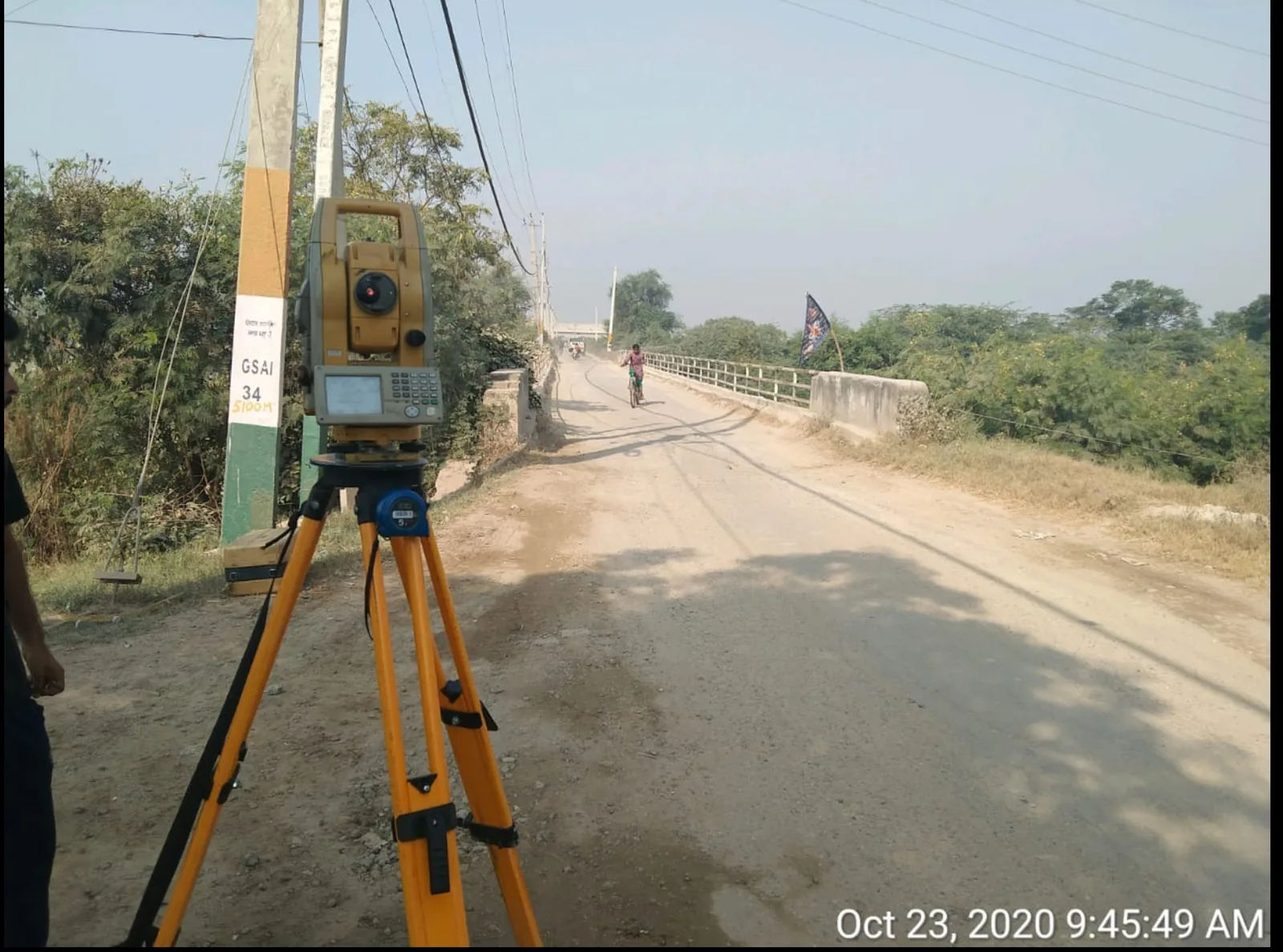
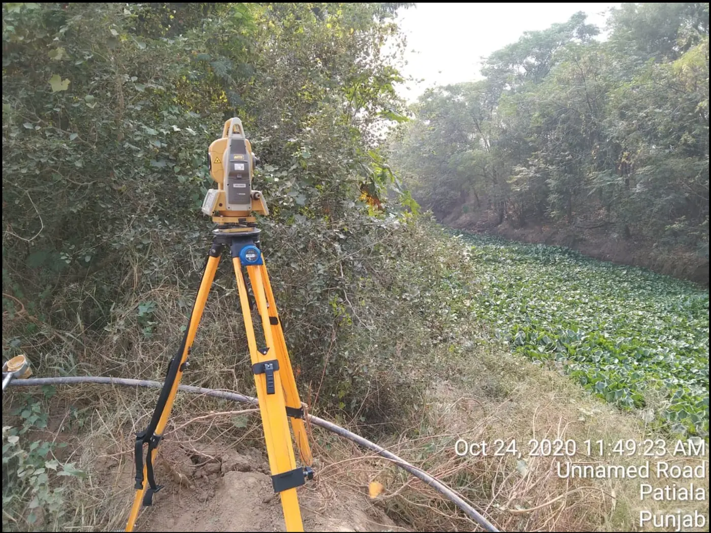
The crew picks up all visible features within the survey area: building corners, road edges, drainage, utilities, fences, vegetation, ground breaks, and elevation grid points. DGPS is used in open terrain, total station in obstructed areas. Each feature is coded for automatic CAD line-work generation. For large area surveys, the drone captures georeferenced imagery against the GCPs established in Step 3.
Field data is downloaded, checked for completeness, and processed against control point reference. Photogrammetric data (drone) is processed through block adjustment in Pix4D or Trimble Business Center. Outliers and gaps are identified for re-survey before demobilisation. Survey accuracy report is generated with closure statistics.
Processed survey data is imported into AutoCAD Civil 3D for DTM generation. Contour lines are interpolated at the project-specified interval (0.25 m / 0.5 m / 1.0 m / 2.0 m). Cross-sections are automated at design chainages. Final drawings are prepared in DWG, DXF, KML, and PDF formats with full feature linework, annotations, and drawing borders.
The final survey report includes a methodology narrative, control point coordinate table with accuracy statement, equipment calibration certificates, contour drawings, cross-section sheets, DTM file, earthwork volume calculation, and a KML overlay for client verification against satellite imagery. Hard-copy plus complete digital package is handed over.
NKMPV Research and Development LLP delivers professional topographic survey services across India for architects, DPR consultants, infrastructure developers, and government agencies. Our survey deliverables are accepted by NHAI, state PWDs, urban development authorities, and private developers.
For an architectural project, the topographic survey is what tells you whether the building site has 1 metre of fall across 50 metres or 4 metres. That single fact determines foundation depth, plinth levels, drainage layout, retaining-wall requirements, and parking-ramp grades. A wrong topo survey causes downstream redesign — and downstream redesign on a project under construction is expensive.
NKMPV captures architectural site topography at 0.25 m or 0.5 m contour intervals with full feature pickup: existing trees, drainage paths, neighbouring building corners, fence lines, water bodies, drainage outfalls, and underground utilities (where visible at surface). Output is delivered as AutoCAD .dwg with proper layer structure (existing-trees, contours-major, contours-minor, drainage, boundaries, utilities) so the architect's CAD team can drop it into their design template without re-organisation.
For a highway, expressway, or PMGSY DPR, the topographic survey is the foundation deliverable that drives every downstream design decision: alignment, vertical profile, cross-section design, earthwork quantity estimation, drainage design, and structures siting. NHAI, MoRTH, and state PWDs mandate DPR-grade topographic surveys at IRC SP 19 specification.
NKMPV delivers DPR-grade corridor topographic surveys with: (1) primary control-point network at 500-1000 m intervals along the project corridor, established by static DGPS observation and least-squares network adjustment; (2) cross-section data at 25-50 m intervals extending 25-50 m on either side of the proposed centreline; (3) feature pickup including all existing structures, utilities, drainage, level-crossings, and right-of-way markers; (4) Digital Terrain Model (DTM) for direct import into Civil 3D, MX, or Bentley OpenRoads; (5) earthwork volume computation against client-provided design profile; (6) plan-profile drawings, cross-section sheets, and longitudinal section ready for DPR consolidation.
State revenue departments require topographic survey-based mapping for highway land acquisition compensation calculation, ROW (Right-of-Way) demarcation, and revenue-record reconciliation. Urban development authorities — HRERA, GMADA, HUDA, RERA, MMRDA — require topographic survey-based layout plans for plotted-development approval, FAR (Floor Area Ratio) computation, and drainage / sewerage planning.
NKMPV's deliverables for these use cases include: (1) coordinate-list of all corner pillars, fence lines, and visible boundary markers; (2) GIS shapefile output compatible with state revenue department geo-referencing systems; (3) area computation reconciled with revenue records (khasra-girdawari numbers where available); (4) ROW boundary marking with concrete pillars and steel pins for permanence; (5) survey-of-India datum reference for legal defensibility.
Most topographic projects need more than one method. The right combination depends on terrain, obstruction profile, area, and accuracy spec.
DGPS (Differential GPS / RTK): Best for corridor and open-area work. Centimetre-accuracy capture at 4-8 km/day per crew. Limited by satellite visibility — degraded under tree canopy and urban canyons.
Total Station: Best for obstructed urban sites, building footprint mapping, and detailed architectural site survey. Line-of-sight measurement avoids satellite issues. Accuracy 2-5 mm + 2 ppm. Lower productivity (1-2 ha/day for detailed pickup) but indispensable for sites where DGPS cannot achieve fix.
Drone-Photogrammetry: Most economical for areas above 50 hectares with surveyed Ground Control Points. NKMPV operates DJI Phantom 4 RTK and Mavic 3E with Pix4D / Trimble Business Center processing. Productivity 100-600 hectares/day. Accuracy 1.5 cm with GCPs. Limited by airspace permissions, dense canopy, and steep slopes.
For most real projects, NKMPV recommends a hybrid: DGPS for primary control + open corridor work, total station for obstructed segments, and drone-photogrammetry for large area capture above 50 hectares. We plan the methodology against your accuracy spec, deliverable format, and budget before mobilising the crew. Read the related: DGPS vs Total Station — When to Use Each for Highway Projects.
Unlike directory listings or vendors who quote opaquely, NKMPV publishes indicative pricing transparently so DPR consultants and architectural firms can budget the survey line item before issuing the RFQ.
Project-specific quotes are available on request — share your project location, area / corridor length, accuracy spec, and required deliverables for an itemised quote within 24 hours.
NKMPV regularly responds to topographic survey tenders issued by NHAI, NHIDCL, state PWDs, BRO, urban development authorities, and private DPR consultants. Our tender-stage deliverables include: NABL accreditation certificate (TC-14144), past-experience documentation, equipment calibration certificates, technical methodology against the tender BoQ (Bill of Quantities), and price submission per tender pro-forma. We have supported tender bids for DPR projects across North India with strong success rate where NABL accreditation and pricing transparency are evaluation criteria.
NKMPV is headquartered in Pinjore (5 km from Panchkula, 12 km from Chandigarh, 25 km from Mohali) and serves topographic survey clients across:
Share your project details — location, area / corridor length, contour interval, deliverable formats, and timeline — and our team will respond with an itemised quote within 24 hours. Contact us for topographic survey services → or call +91-82953-60108.


NKMPV's testing laboratory holds NABL Certificate TC-14144 (ISO/IEC 17025:2017), so soil and material tests for the same site are reported from an accredited laboratory.
Unlike directory listings or vendors who quote opaquely, NKMPV publishes indicative per-hectare and per-kilometre rate ranges so DPR consultants and architectural firms can budget topo line items in the RFQ stage. See pricing reference below.
Most topo projects need more than one method. We deploy whichever combination is most cost-effective — DGPS for fast corridor capture, total station for obstructed urban sites, drone-photogrammetry for areas above 50 hectares — saving project budgets without compromising accuracy.
Output includes DWG/DXF for AutoCAD Civil 3D, GIS shapefiles for ESRI ArcGIS / QGIS, KML/KMZ for Google Earth verification, PDF drawings for printing, and Civil 3D-compatible DTM files. No re-formatting required by the client design team.
Our crews mobilise from Pinjore HQ within 24-72 hours of confirmed quote. Strong project delivery record across Haryana, Punjab, Himachal Pradesh, Chandigarh Tri-City, with project mobilisation across India for clients with central or southern Indian sites.
Unlike standalone survey firms, NKMPV combines topographic survey with <a href='/services/cbr-test'>geotechnical testing</a>, <a href='/services/falling-weight-deflectometer-fwd-test'>pavement evaluation</a>, and <a href='/services/concrete-cube-core-testing'>material testing</a> — single-window solution for complete highway, building or DPR investigation.
A topographic survey is a detailed graphical representation of natural and man-made features of a land area, including their horizontal positions (X, Y coordinates) and vertical elevations (Z). The deliverable is a topographic map showing contours at specified intervals (typically 0.5 m or 1.0 m), spot levels at key points, all natural features (vegetation, water bodies, rock outcrops), and all man-made features (buildings, roads, drains, utilities, fences). Used for: highway alignment design, site grading, building footprint planning, land acquisition mapping, drainage design, and project DPRs. Modern topographic surveys use DGPS / RTK GNSS for primary positioning, supplemented by total station for built-up areas and UAV photogrammetry for area mapping.
The two terms overlap but are not identical: Topographic survey is the broad service of mapping ground features — includes data collection (by any method), processing, and the final topographic map deliverable. DGPS survey is one of the data collection methods used within a topographic survey — high-accuracy GNSS positioning for horizontal and vertical coordinates. A topographic survey may use DGPS exclusively, total station exclusively, or a combination depending on terrain. Practical example: a 50 km highway corridor topographic survey typically uses DGPS for centerline and centerline-adjacent features, total station for built-up areas, and UAV photogrammetry for the wider area. NKMPV's DGPS survey service is the GNSS-based subset of our full topographic survey capability.
Topographic survey pricing in India varies with terrain (plain vs hilly), survey method (DGPS, total station, or drone-photogrammetry), area or corridor length, accuracy tier, and deliverable scope — so it is best quoted against your specific project rather than a single flat rate. For indicative ranges across project types, see our topographic survey cost guide, or share your project location, area / corridor length, accuracy spec, and required deliverables and our team will return an itemised quote within 24 hours.
Coverage
Wherever your project is, there are two ways to work with NKMPV on Topographic Survey.
For field work, our engineers and instruments mobilise anywhere in India — highway corridors, bridges, plants and greenfield alignments included.
Distance is not a constraint for laboratory testing. Send samples to our Pinjore laboratory and receive the digital report on completion — the route most of our out-of-region clients use.
These are locations where we have completed projects — not the boundary of our service area. We mobilise across India on request. See full coverage & project locations →
Topographic Survey is carried out to Survey of India Guidelines, ISO 17123-3, IRC SP 19:2001 and MoRTH Section 100, as listed in the Applicable Standards section of this page. Tell us the specification your project must comply with and the quotation will state the standard the work follows.
Our laboratory is at Pinjore, Haryana, within same-day reach of Chandigarh, Panchkula, Mohali, Ambala and the wider Tri-City. If you are further away, distance is not a constraint: our field team travels to site anywhere in India for on-site work, and for laboratory tests you can courier samples to the Pinjore lab and receive the report digitally. Clients across Punjab, Haryana, Himachal Pradesh, Delhi-NCR, Uttarakhand, Rajasthan, Uttar Pradesh, Jammu and Kashmir and Ladakh already work with us this way.
Yes. NKMPV operates pan-India. We have delivered projects across Chandigarh, Panchkula, Mohali, Ambala, Karnal, Kurukshetra, Yamunanagar, Hisar and beyond, and we mobilise to greenfield and remote corridors on request. The 18 locations listed on our site are the places we have already worked — not the limit of where we go.
Send us the project details — location, quantity, and the standard you need to comply with — and you get a written quotation, usually within one working day. Pricing depends on sample count, site access and mobilisation distance, so we quote per project rather than publishing a fixed rate. Call +91-82953-60108 or use the quote form; every quotation states the applicable IS/IRC standard.
Need Topographic Survey for your project?